 |
|||||||||
 |
|||||||||
 |
 |
||||||||
| Ranney Knob Area
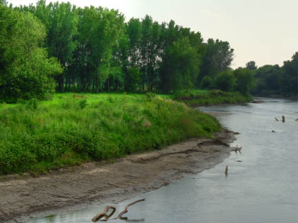
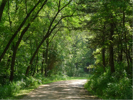
Lowland and upland timber have a variety of spring wildflowers in the understory. There is a major prairie restoration underway with bluestem, Switchgrass, Indian Grass, and side oats gramma as well as a variety of flowers coming on due to brush removal and controlled burning. An old county road, no longer accessible to vehicles, provides walking access along the river, within the timber. River Corridor Ample river access provides viewing for otter, beaver and mink. You will find eagles wintering in the area. Location Description Ranney Knob Area is located on the southwest edge of the town of Washta, just off of C 66. communities on the preserve range from dry to wet prairie and marsh. the site. Driving Directions and other Information
|
|||||||||
| Visit Ranney Knob Area via Google Map by Clicking HERE!
(Please disable your browser's popup blocker before viewing map) |
|||||||||
|
Take a short visit Ranney Knob Area via the video below! |
|||||||||
| Wild Categories | Photo Gallery | ||||||||||||||||