 |
|||||||
 |
|||||||
 |
|||||||
| Devil's Ridge Wildlife Management Area
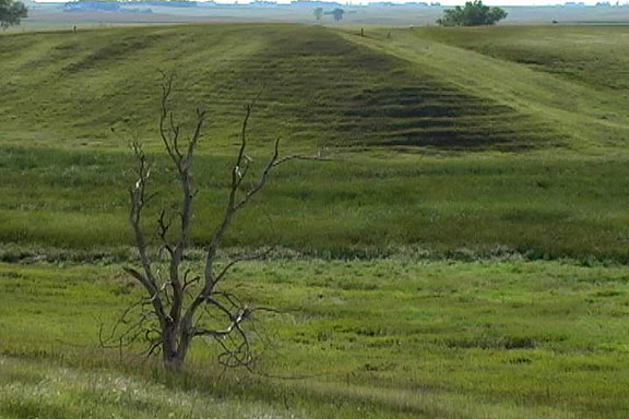
Bring your camera for this extremely photogenic location!! From the parking lot walk along the fence line and climb the ridge of the lateral moraine. At this vantage point you can truly step back in time! As you look to the south and west you see the flattened landscape in which a herd of bison can be imagined. Now turn to the northeast and the footing completely drops from your view. This site is thought to have been a “Bison Jump Site,” which Native Americans used to harvest buffalo. Walk down the “nose” of the ridge and you can actually feel the bumps of the loess soil formed into catsteps! Geological History This site shows a textbook example of a lateral moraine. Rubble, piled up as the glacier receded, formed a ridge in the otherwise flat landscape. The moraine was covered with blown silt (loess) to cover the ridge with what appears to be “steps” from afar. Also on this site are a kame in the northeast corner and a kettle hole in the northwest corner. For more information on these features check out the descriptions of two other sites on the Glacial Loop - the Ocheyedan Mound (kame) and the Freda Hefner Kettlehole (kettlehole). Location Description This high quality restored prairie shows excellent examples of Lead plant, Pale purple coneflower, and Gray-headed coneflower. The wet marsh at the base of the lateral moraine and the stream running through the property on the west side provide suitable sites for rushes and cattails. Hunting is allowed on this site. Pheasants and Gray Partridge can be found here along with a variety of songbirds such as Western Meadowlarks and Eastern Bluebirds. |
|||||||
|
Driving Directions and other Information
|
|||||||
Educational Avtivity:
|
|||||||
| View Devil's Ridge WMA via Google Map by Clicking HERE! (Please disable your browser's popup blocker before downloading) | |||||||
| Download Devil's Ridge IPOD Video HERE | |||||||
| View Devil's Ridge on Video now Below - | |||||||