 |
||||||||||||||||||||||
 |
||||||||||||||||||||||
 |
 |
|||||||||||||||||||||
| Fen Valley
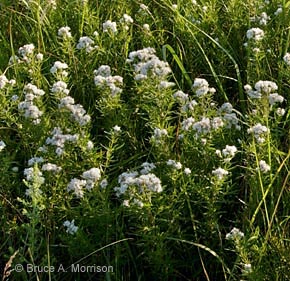
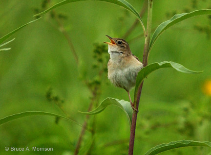
You can’t see much from the parking lot, but this stop is well worth the walk. Hike to the left around the food plot and down the hillside. See morainal hills and an oxbow stream. Bend down and listen. Where is the water coming from? Do you see that the cattails and rushes are up on the hillside instead of down low? The “squish” under your feet reminds you that you are at a fen. Geological History A fen is a waterlogged, spongy deposit of peat which accumulated over thousands of years around an area of groundwater seep. Many unusual plants are found in a fen, due to the high concentration of minerals in the groundwater. The cattails and rushes show where water is seeping out of the hillside. Location Description The 8 fens, 20 acres total, have a maximum peat thickness of 12 feet. Associated with this unusual formation are a more than 60 native plants including Nutrush, Arrow grass, Kalm’s lobelia, Grass of Parnassis, as well as Boneset, Joe pye weed, Mountain mint, Cup plant, Horsemint, Gray-headed coneflower, Porcupine grass, Horsetail, and Ironweed. Also found here: bobolinks, Common Yellowthroat, Song Sparrow, Pheasant, Sedge Wren, Meadowlark, Henslow’s Sparrow, Grasshopper Sparrow and Northern Harrier. 17 species of land snails have been documented and studied at this site. Driving Directions and other Information
|
||||||||||||||||||||||
|
Educational Activity: |
||||||||||||||||||||||
|
View Fen Valley via Google Map by Clicking HERE! (Please disable your browser's popup blocker to view map) |
||||||||||||||||||||||
| Wild Categories | Photo Gallery | |||||||||||||||||||||