 |
|||||
 |
|||||
 |
|||||
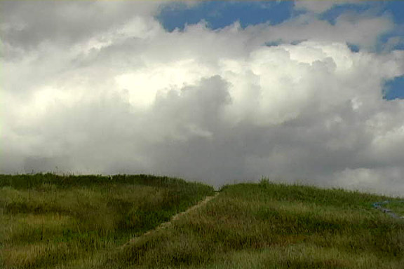
| Ocheyedan Mound
This isolated hill is an imposing feature standing tall in the middle of the flat plains. It was once thought to be the site of the state’s highest elevation. It was surpassed by a hog lot (now called Hawkeye Point) in the same county (Osceola) and now ranks even lower on the list due to the elevation of landfills in the area. Follow the path to the peak of this kame and you will have a wonderful view of the surrounding area. Geological History A kame is a cone-shaped knob composed mostly of sand and gravel deposited when a debris laden stream flowing on the glacier’s surface dropped into a cavity in the ice gradually filling it. As the surrounding ice melted or receded this mountain of sand and gravel remained. Small kames are numerous throughout the morainal country of Northwest Iowa, but few can match the Ocheyedan Mound. This landmark marks the farthest western advance of the Des Moines Lobe ice in this part of Iowa. Location Description Rush Lake and Sutton Lake basins just to the north of this site draw wildlife to the area. A variety of raptors – including Cooper's Hawks, Redtails, Kestrels, Sharpshins and Harriers – take advantage of warm air rising off the mound to soar above the fields searching for prey. Dry season prairie plants and grasses can be seen as you hike up the 1/8 mile mowed path to the top of the hill. Hunting is allowed here – mainly for pheasants. Driving Directions and other Information
|
|||||
|
Educational Activity: |
|||||
| View Ocheyedan Mound via Google Map by Clicking HERE!
(Please disable your browser's popup blocker before viewing map) |
|||||
| Take a short visit to Ocheyedan Mound via video below! | |||||
| Wild Categories | Photo Gallery | ||||||||||||||||