 |
|||||||
 |
|||||||
 |
 |
||||||
| Burns Prairie
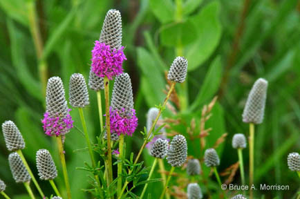
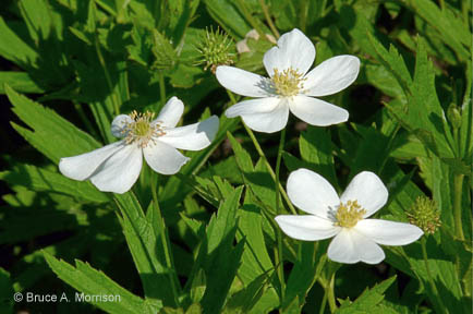
Spring fed native and restored wetlands provide excellent migratory waterfowl watching. Look for Northern Shoveler, Hooded Merganser, Redhead, and Blue-winged Teal as well as Yellow-headed Blackbird. Shorebirds will be present depending on water levels. This area is open to waterfowl and Pheasant hunting. Prairie History Native and restored prairie provide excellent examples of tallgrass prairie flowers May through October. The prairie is home to Bobolink and Field Sparrow, Dicksissel and Sedge Wren. The threatened smooth green snake can be found here.. Location Description Burns Prairie is located 5 miles west of Emmetsburg on 370th Street (west of the airport). Driving Directions and other Information
|
|||||||
| Visit Burns Prairie via Google Map by Clicking HERE!
(Please disable your browser's popup blocker before viewing map) |
|||||||
|
Take a short visit to Burns Prairie Area via the video below! |
|||||||
| Wild Categories | Photo Gallery | ||||||||||||||||